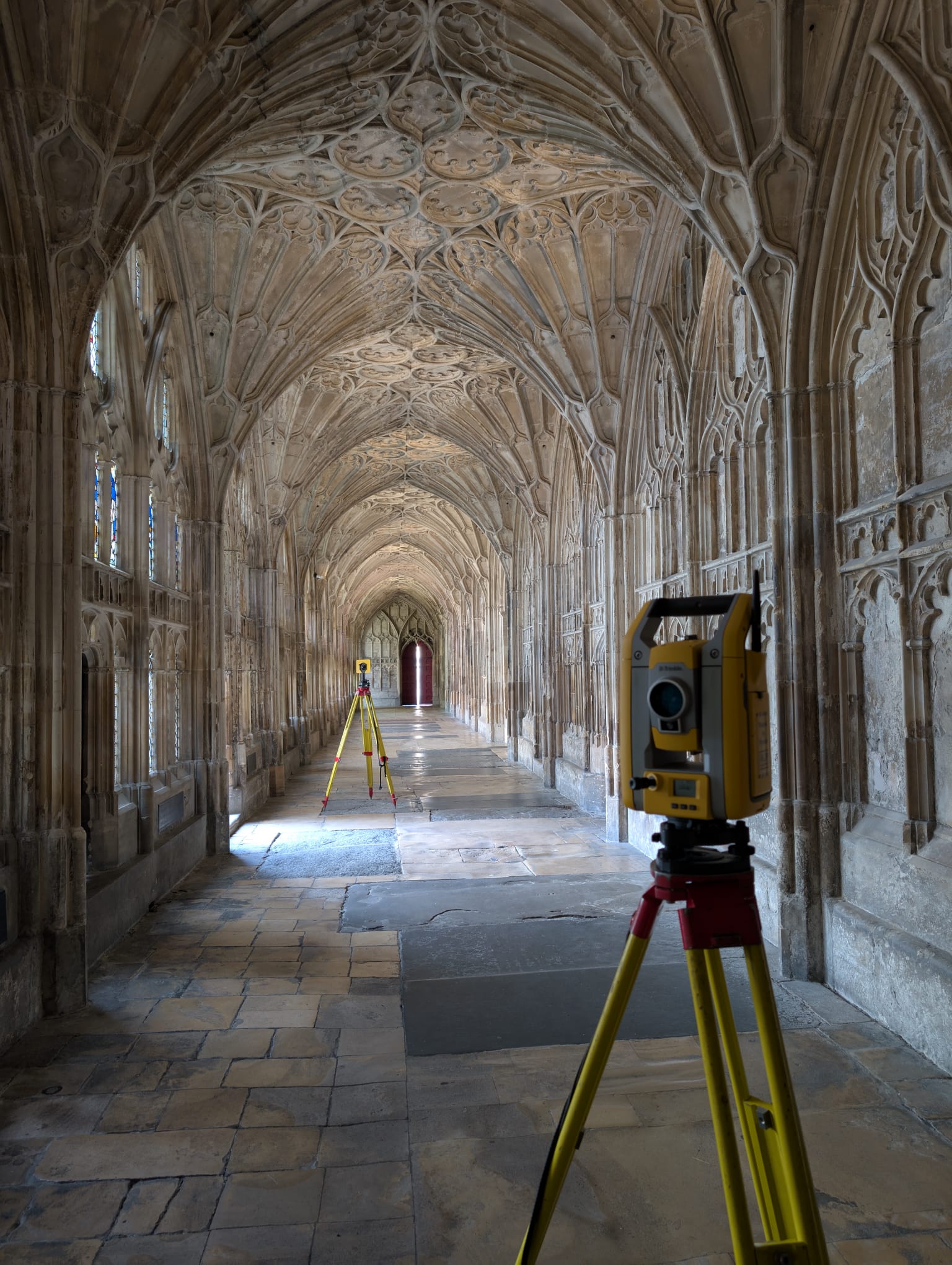
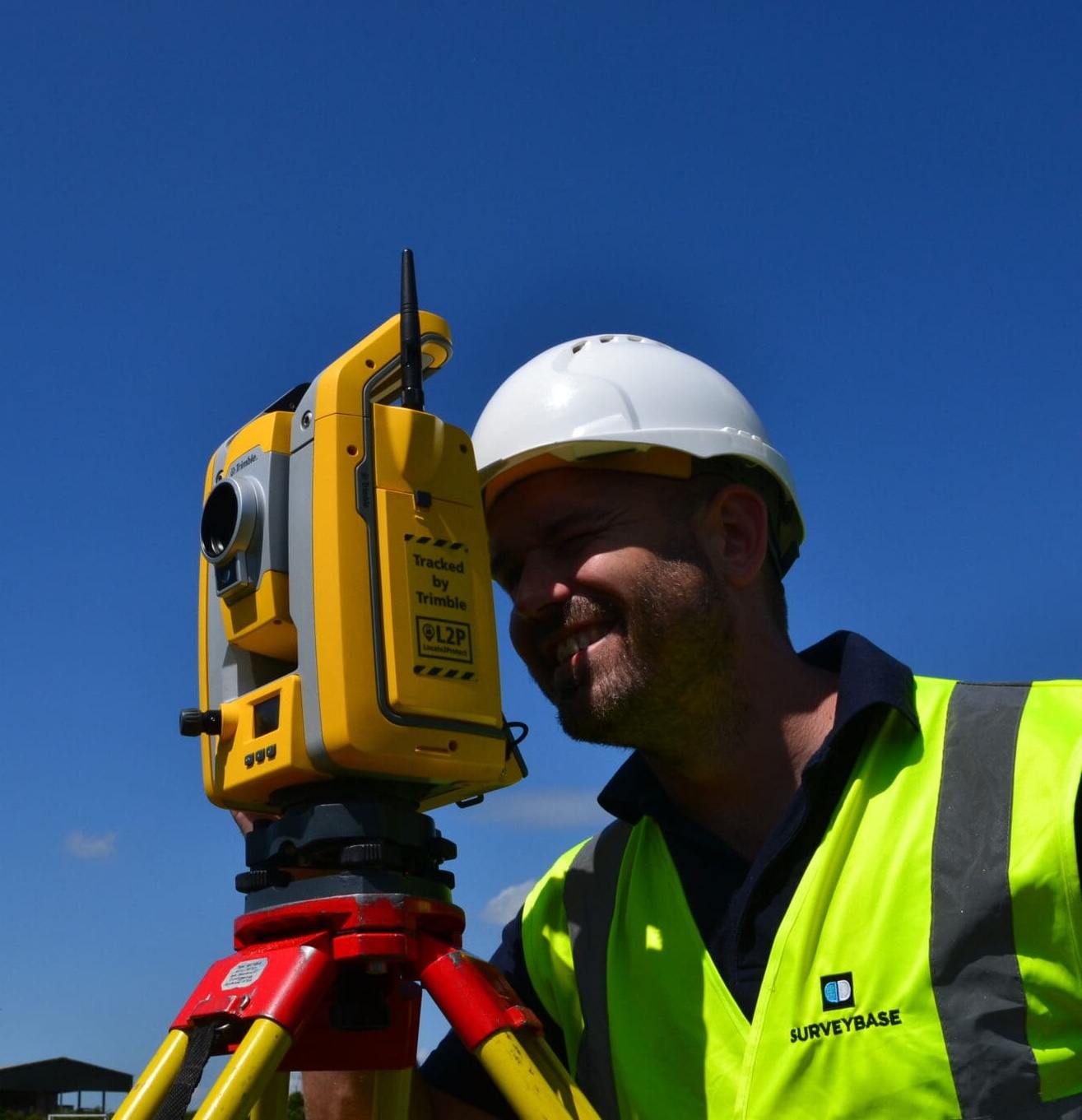
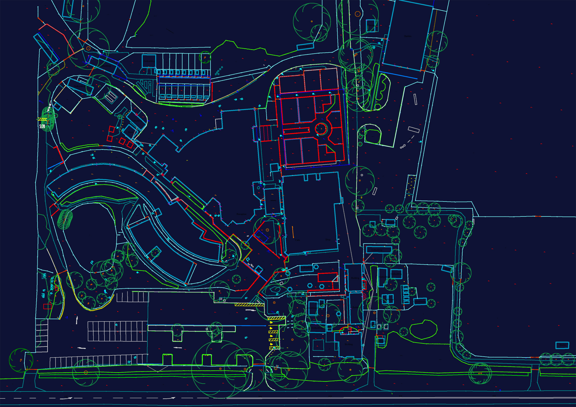
Since 1997, Surveybase has been a trusted leader in Topographical Surveys, offering nationwide coverage and delivering accurate, high-quality 2D and 3D survey data. Our proven expertise guarantees precise terrain mapping for design, planning, and compliance, ensuring total confidence in your project from the outset.
Topographical Surveys are essential for a wide range of projects across the architecture, engineering, construction, and land development sectors. They are particularly beneficial for:
A Topographical Survey gives you a clear, reliable understanding of your site’s physical features, helping you make informed decisions with confidence, from early planning through to final delivery.
A Topographical Survey, also known as a land survey or site plan, provides detailed and accurate information about the physical features of a site. It records both natural and man-made elements such as contours, ground levels, boundaries, utilities, buildings, trees, and key landmarks.
Using advanced surveying technology, including Total Stations, GPS, 3D laser scanners, UAV drones, and mobile mapping systems, precise spatial data is captured and processed to produce high-quality outputs in both 2D and 3D formats, tailored to the specific requirements of each project.
Topographical Surveys play a vital role in supporting architects, engineers, planners, and developers by providing critical site and measurement information that enables confident decision-making at every stage of the process.
We offer a structured 2-tier approach to Topographical Surveys, ensuring our service aligns with your project’s specific needs and budget. This approach is based on industry best practices and common client requirements, allowing you to select the level of detail necessary for your development.
Yes, it can. At Surveybase, we are integrated survey specialists, offering a full range of coordinated surveying services. We can seamlessly combine topographical surveys with underground utility surveys, measured building surveys, and more, delivering detailed, accurate outputs that support efficient design and project planning. By integrating surveys, we help reduce risks, streamline project workflows, and save time on site.
Scroll down to explore our full range of integrated surveying services.
A topographical survey is carried out using specialist equipment such as total stations, GPS, and 3D laser scanners to accurately capture the natural and man-made features of a site. We record levels, boundaries, buildings, trees, roads, and other visible elements. The data is then processed to create a detailed, scaled digital map that supports planning, design, and construction work.
The cost of a Topographical survey depends on factors such as the size of the area, location, and the level of detail required. To get an accurate price tailored to your project, get in touch with us and we’ll provide a detailed quote.
Unlock the benefits of integrated surveying services with Surveybase. Our comprehensive solutions combine a range of services to deliver efficient, accurate, and cost-effective results, supporting every phase of your project with precision and reliability.
Surveybase is a recognised leader in Underground Utility Surveying. With our nationwide service, we deliver accurate and reliable underground utility mapping solutions, helping clients mitigate risks, enhance safety, and ensure compliance, providing confidence in your project from the outset.
Since 1997, Surveybase has been a trusted leader in Measured Building Surveys. Providing nationwide coverage, we deliver precise and dependable 2D and 3D outputs, ensuring complete confidence in your project from day one.
Surveybase is a trusted leader in CCTV Drainage Surveys across the UK. Our nationwide service delivers accurate and reliable inspections to assess the location, condition, and repair needs of drainage systems. Whether for pre- construction planning or ongoing maintenance, we provide the insight and assurance you need, right from the start.
Surveybase provides high-precision Drone Surveying & Inspection services across the UK, delivering fast, cost-effective, and detailed aerial data. Our CAA-certified pilots use advanced UAVs with high-resolution cameras and LiDAR for precise, reliable surveys.
Each project highlights our dedication to accuracy, innovation, and delivering integrated surveying services. Discover how we’ve helped clients achieve successful outcomes with precise, high-quality data.
To obtain a quotation, please email your survey brief to: quote@surveybase.co.uk or use our online quote portal.