Since 1997, Surveybase has been a trusted leader in Photogrammetry, providing nationwide coverage and delivering precise, detailed, and reliable 3D models for measurement, inspection, and analysis.
What projects can benefit from Photogrammetry?
Photogrammetry is a versatile surveying solution, ideal for a wide range of project types. Sectors and projects that can benefit include:
Heritage and Conservation – creating accurate, non-invasive records of historic buildings, monuments, and landscapes.
Construction and Development – site surveys, progress monitoring, volume calculations, and visual records.
Architecture and Design – capturing existing site and building conditions for design, renovation, and planning.
Infrastructure and Transport – mapping roads, rail, bridges, and large-scale infrastructure projects with speed and precision.
Utilities and Energy – surveying pipelines, powerlines, solar farms, and wind installations for inspection and maintenance.
Environmental and Land Management – monitoring landscapes, coastal areas, and flood plains for environmental analysis and management.
With rapid data capture, scalable coverage, and highly visual, measurable outputs, photogrammetry is especially valuable for projects requiring detailed, up-to-date information.
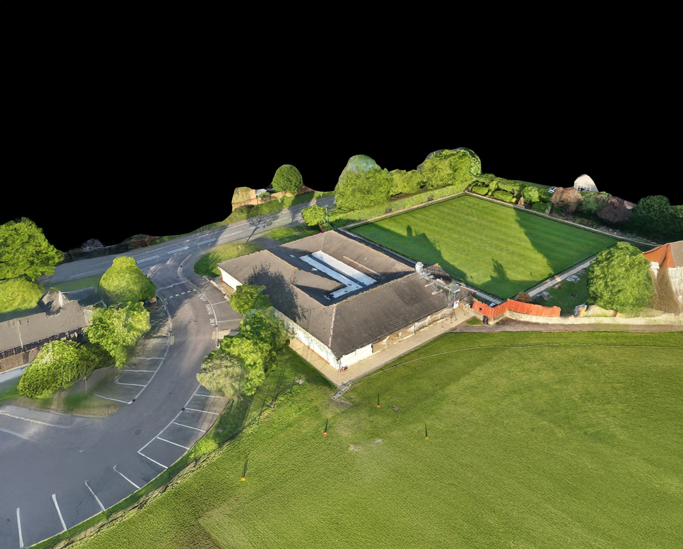
What is Photogrammetry
Photogrammetry is a surveying technique that captures high-resolution photographs, typically using drones or specialist cameras, to produce precise, scaled 2D drawings and 3D models. By processing multiple overlapping images, it accurately records the size, shape and position of land, buildings and structures.
Typical deliverables include high-resolution images, orthophotos, point clouds and textured 3D models, providing clients with accurate, visual and measurable data to support project planning, design, analysis and informed decision-making.
Unlock the benefits of integrated surveying services with Surveybase. Our comprehensive solutions combine a range of services to deliver efficient, accurate, and cost-effective results, supporting every phase of your project with precision and reliability.
Measured Building Surveys
Since 1997, Surveybase has been a trusted leader in Measured Building Surveys. Providing nationwide coverage, we deliver precise and dependable 2D and 3D outputs, ensuring complete confidence in your project from day one.
Surveybase provides high-precision Drone Surveying & Inspection services across the UK, delivering fast, cost-effective, and detailed aerial data. Our CAA-certified pilots use advanced UAVs with high-resolution cameras and LiDAR for precise, reliable surveys.
Since 1997, Surveybase has been a trusted leader in delivering Rectified Imagery. Providing nationwide coverage, we offer precise, high-resolution imagery that is accurately scaled and geo-referenced to support your project needs.
Each project highlights our dedication to accuracy, innovation, and delivering integrated surveying services. Discover how we’ve helped clients achieve successful outcomes with precise, high-quality data.
We’re here to support your project with accurate surveys and expert advice. Get in touch today to speak to one of our experts and find out how we can help.
Request a quote
To obtain a quotation, please email your survey brief to: quote@surveybase.co.ukor use our online quote portal.