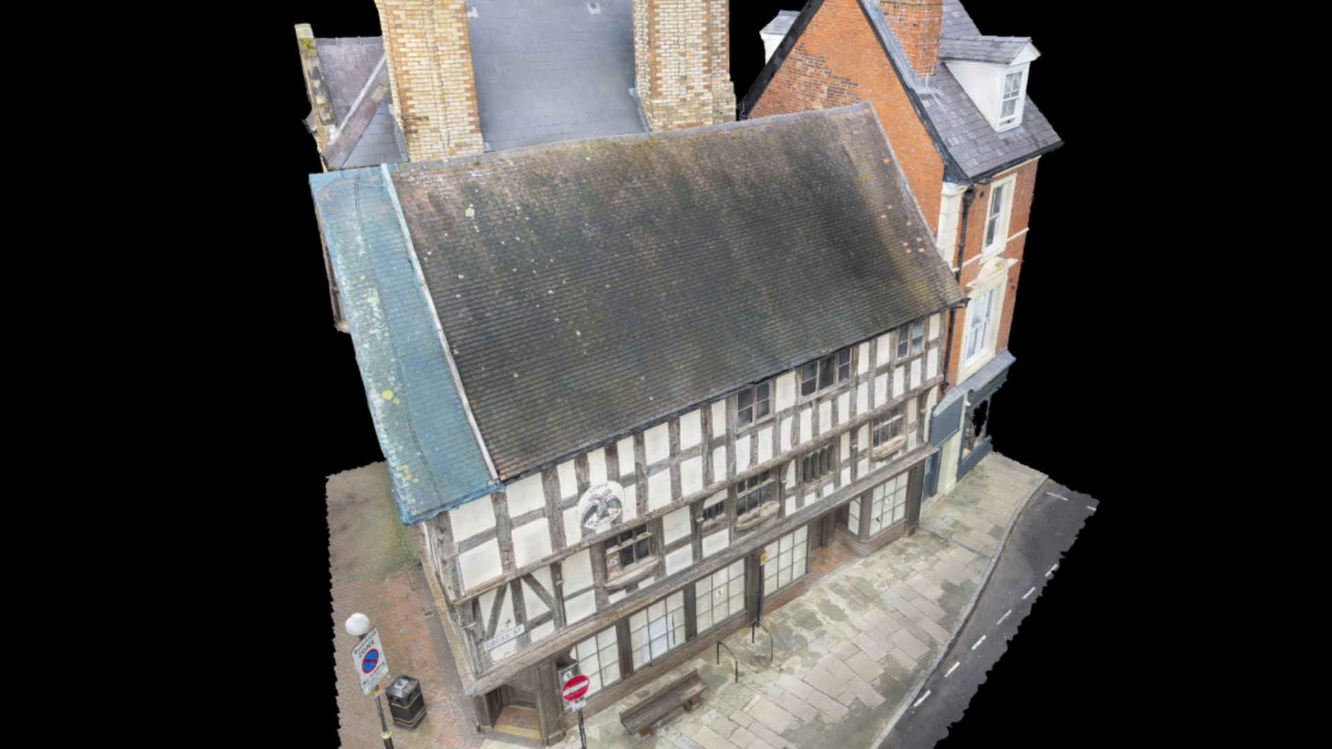
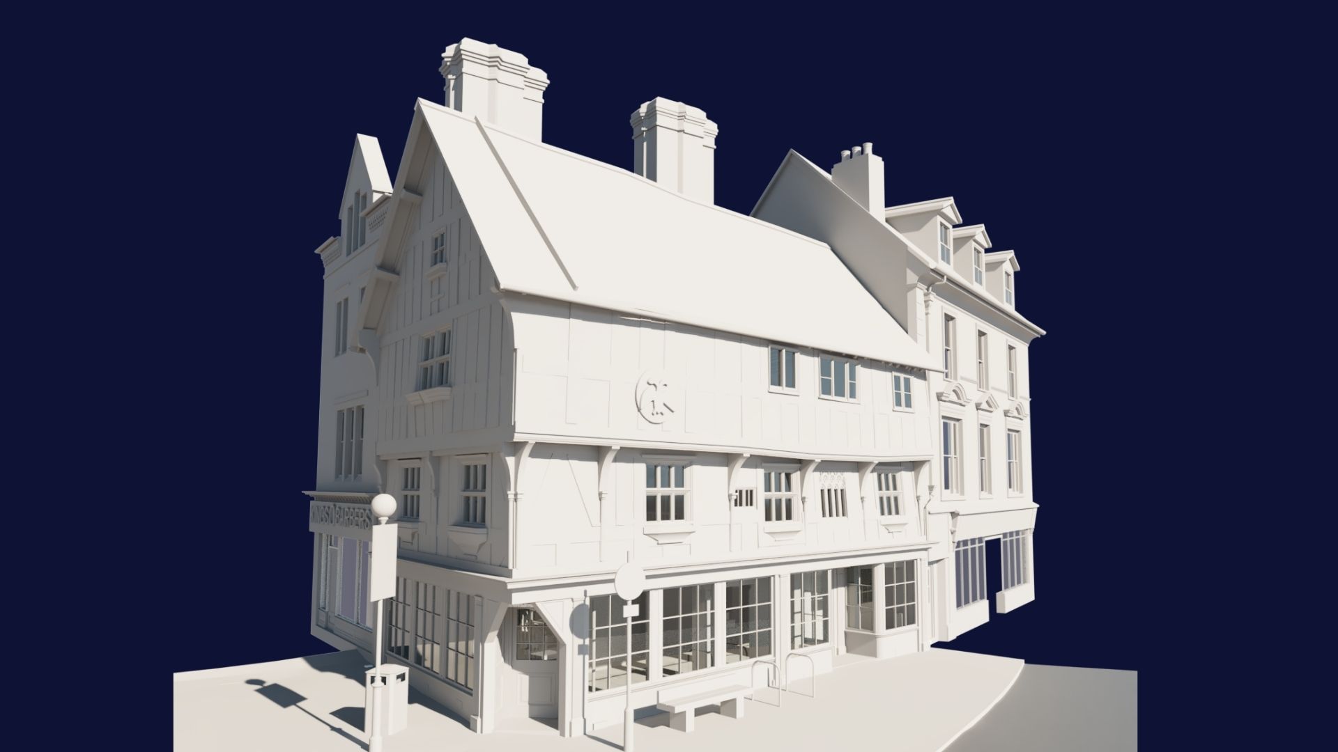
Llwyd Mansion is a Grade I listed medieval timber-framed building located in Oswestry, Shropshire, dating back to the late 15th century
Details
Title
Service
3D Revit BIM Modelling, Drone & Aerial Inspections
Method
Drone, Laser Scanner
Deliverables
3D Revit Model
Project gallery
Originally built as a wealthy merchant’s house, it was remodelled in the early 1600s with additional storeys and decorative features. Today, it is recognised as one of Oswestry’s most significant historic buildings and is undergoing restoration.
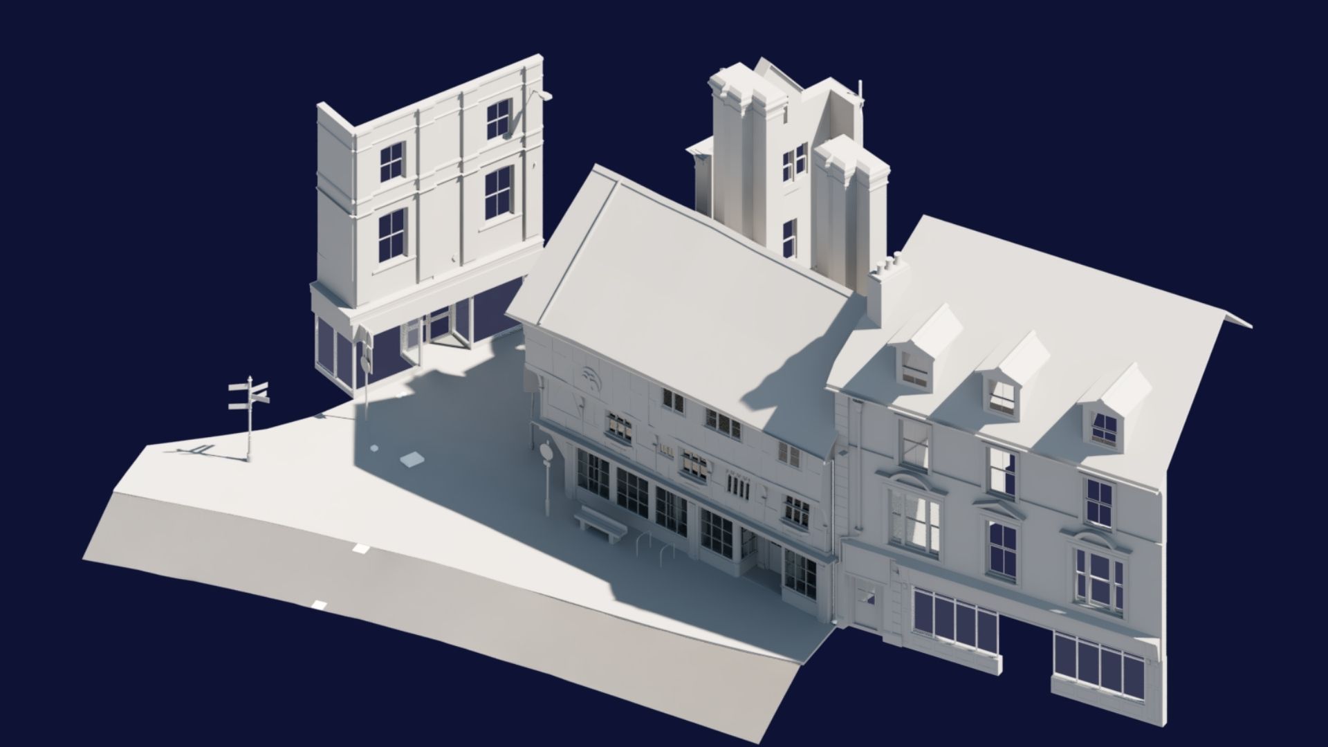
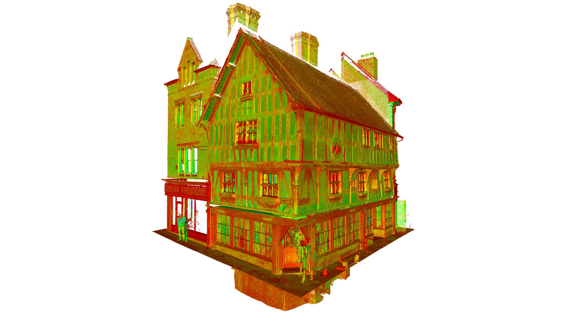
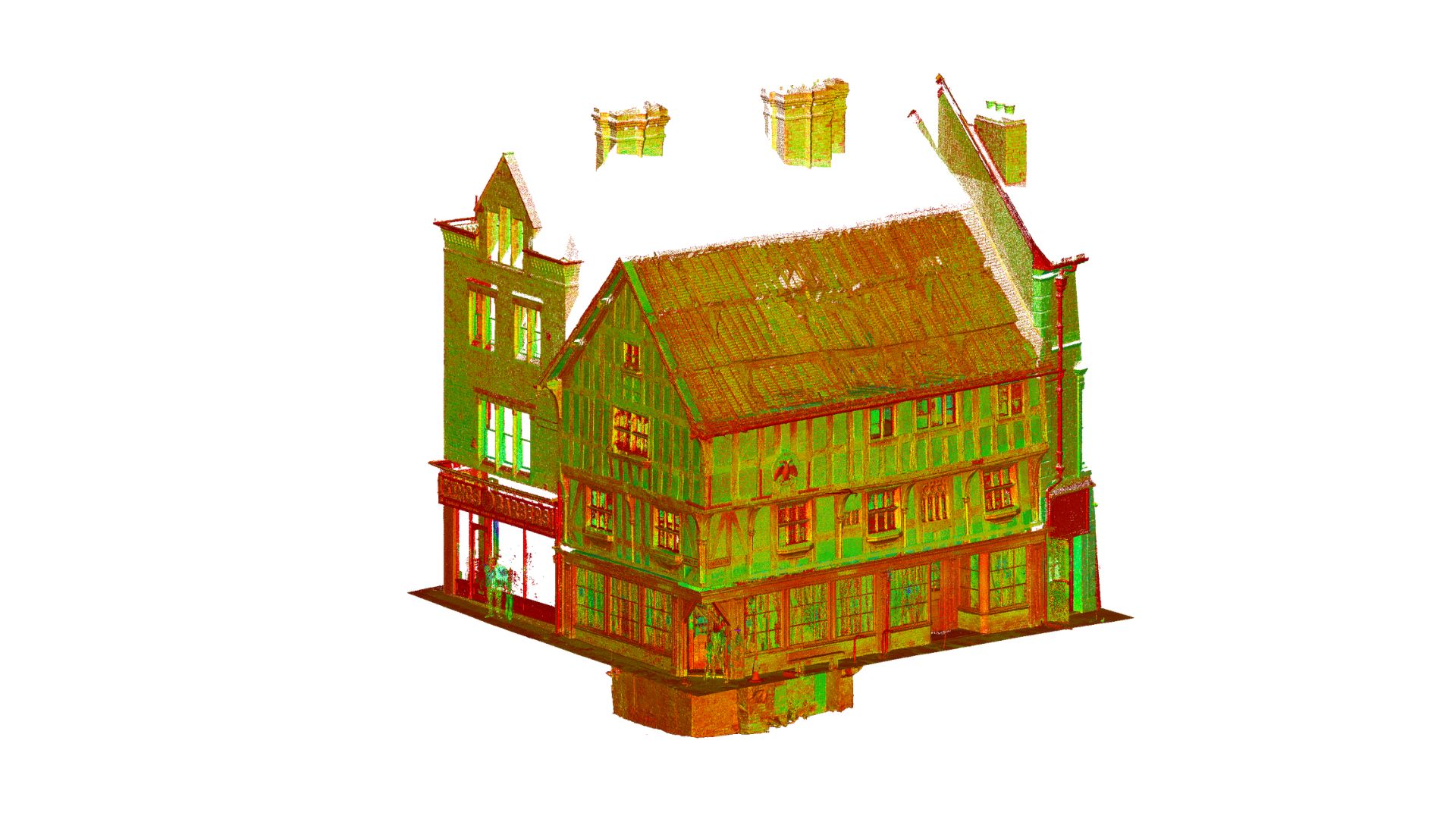
Surveybase was appointed to deliver a 3D BIM,Drone Survey, and 3D Textured Model survey of the building and surrounding buildings. This provided the client with an accurate 3D BIM model delivered to LOD4 external and LOD3 Internal standards, and a 3D Textured Model, which can be viewed here.
Surveying this site came with a unique set of challenges. To overcome this, Surveybase utilised advanced surveying technology, including a drone to ensure accurate data collection in a timely manner.
This project underscores Surveybase’s commitment to delivering high-quality, cutting-edge surveying services. By providing our surveying services, we ensure clients receive a complete, coordinated and accurate dataset. This approach streamlines the design and planning process, reduces risk, and supports more efficient project delivery.
This building joins prestigious sites within our portfolio, and each project reflects Surveybase’s expertise in delivering precise surveys for complex buildings.
We combine almost 30 years of business with the latest surveying technology to deliver accurate, efficient, and professional results across the UK. Whether you’re planning a residential development or a large-scale commercial project, our expert team is here to help. To get started, visit our Quote Portal for a fast, tailored quote, or email: quote@surveybase.co.uk.
Unlock the benefits of integrated surveying services with Surveybase. Our comprehensive solutions combine a range of services to deliver efficient, accurate, and cost-effective results, supporting every phase of your project with precision and reliability.
3D BIM Surveys
Surveybase provides precise and cost- effective 3D survey services across the UK for commercial, residential, heritage, and industrial properties. Using advanced 3D laser scanning technology, we deliver accurate, site- specific data tailored to each project.
Surveybase provides high-precision Drone Surveying & Inspection services across the UK, delivering fast, cost-effective, and detailed aerial data. Our CAA-certified pilots use advanced UAVs with high-resolution cameras and LiDAR for precise, reliable surveys.
Each project highlights our dedication to accuracy, innovation, and delivering integrated surveying services. Discover how we’ve helped clients achieve successful outcomes with precise, high-quality data.