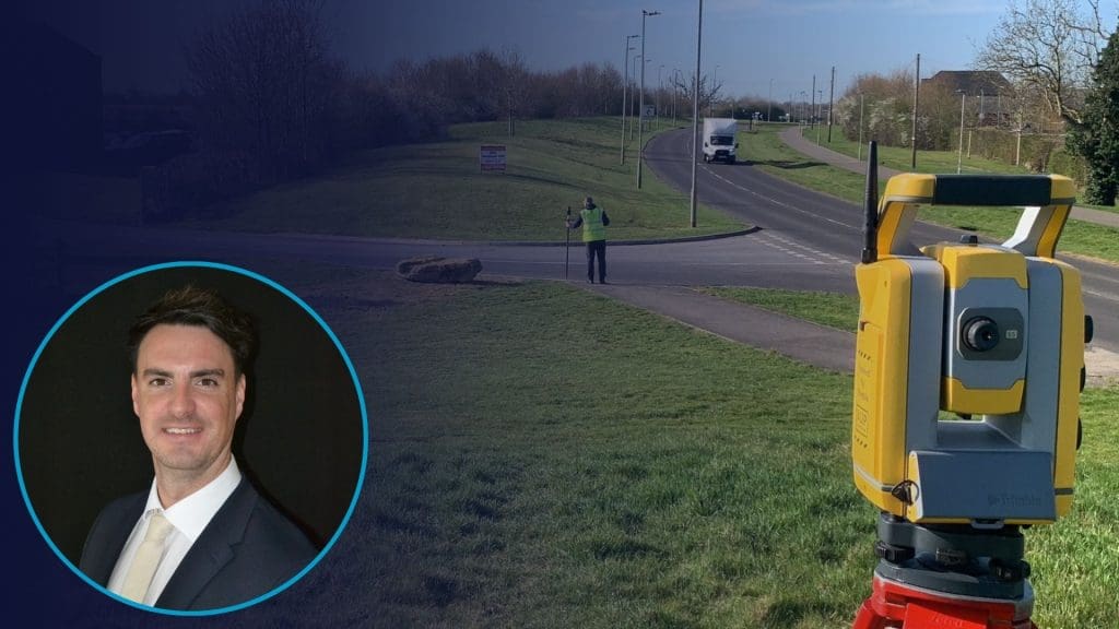
By Jordan King, Managing Director, Surveybase
When planning a construction or development project, having accurate site data from the outset is critical. A topographical survey provides a precise map of a site’s natural and man-made features, enabling architects, engineers, construction professionals, and developers to design with confidence and avoid costly mistakes.
This guide answers the most common questions about topographical surveys, explaining what they are, why they matter, and how they support successful project delivery.
What Is a Topographical Survey?
A topographical survey (also called a Land Survey, Site Plan, or Topo Survey) is an accurate map of a piece of land, capturing both natural and constructed features. It typically includes:
- Ground levels and contours
- Buildings, structures, and hardscapes
- Trees, boundaries, fences, and roads
- Surface drainage features and utilities
Surveyors use precision instruments such as total stations, laser scanners, and UAV drones to capture detailed spatial data. The result is a comprehensive 2D plan or 3D model that forms the foundation for all future design, planning, and construction work.
Why Do You Need a Topographical Survey?
A topographical survey provides critical insight into the existing conditions of your site. Without it, designers and contractors may encounter unforeseen issues during planning or construction, leading to delays and additional costs.
You may need a topographical survey if you are:
- Designing a new building or extension → ensures designs align with actual site conditions
- Applying for planning permission → provides accurate documentation for regulators
- Preparing landscaping or infrastructure plans → avoids redesigns
- Managing land boundaries → prevents disputes or errors
By understanding the exact shape and features of the land, teams can make informed decisions, minimising risk and maximising efficiency.
What Does a Topographical Survey Include?
While every survey is tailored to the project, standard deliverables often include:
- Digital CAD drawings (DWG or PDF)
- Contour lines and spot levels showing changes in surface elevation
- Feature mapping of buildings, trees, walls, and roads
- Surface utility covers; optional underground utility mapping if combined with a utility survey
- Advanced services for complex projects: LiDAR 3D modelling, high-resolution UAV imagery, and BIM integration
How Long Does a Topographical Survey Take?
The time required for a topographical survey depends on the size, complexity, and accessibility of the site. Smaller sites can often be surveyed quickly, in less than a day, while larger or more complex sites may take longer to capture accurately.
After the survey is completed on site, data processing and plan production are carried out promptly, ensuring clients receive reliable, actionable information in a timely manner.
How Much Does a Topographical Survey Cost?
Costs vary based on factors such as:
- Site size and terrain complexity
- Required level of detail
- Vegetation and access
- Additional services such as utility mapping or UAV surveys
Investing in a professional survey upfront often saves significant time and money by reducing errors and design revisions downstream. For an accurate quote, provide a site plan or address to our estimation team.
What Format Will You Receive the Survey In?
Deliverables are typically provided as:
- Digital CAD files (DWG or DXF)
- 3D Revit (BIM) Models (.RVT or IFC)
- PDF plans for easy viewing and stakeholder sharing
When Should You Arrange a Topographical Survey?
Ideally, commission a survey at the start of your project, before design or planning begins. This ensures all decisions are based on accurate site data, reducing the risk of delays, costly redesigns, or compliance issues.
Why Choose Surveybase?
Choosing Surveybase means partnering with a surveying company that combines over 20 years in business, highly trained surveyors, and cutting-edge technology to deliver high-quality results across the UK. Our surveys provide:
- Over 20 years in business: Nearly three decades of experience delivering reliable surveys for projects of all sizes and types.
- Experienced and trained surveyors: Our team is fully qualified, with the skills and expertise to handle projects of any scale or complexity.
- UK-wide coverage: We deliver topographical surveys across the country, ensuring consistent, high-quality service no matter where your project is located.
- Proven credibility: We are ISO 9001 certified, full members of The Survey Association, and accredited by Constructionline and SafeContractor.
- 5-star reputation: Our clients consistently rate us highly for accuracy, professionalism, and reliability, reflected in our industry-leading 5-star Google reviews.
- Efficiency and speed: Surveys are delivered on schedule, enabling project teams to make informed decisions while reducing delays, rework, and costs.
- Advanced technology integration: We leverage UAV drones, 3D laser scanning, and LiDAR to provide detailed, actionable data that integrates seamlessly with CAD and BIM workflows.
- Tailored solutions: Whether residential, commercial, heritage, or large infrastructure projects, our surveys are customised to meet your project’s specific requirements.
Watch: What Is a Topographical Survey?
Watch our short explainer video to understand more!
FIND OUT MORE
If you would like to find out more about our Integrated Surveying Services please visit our Website or contact Surveybase; 0343 841 0112.
REQUEST A QUOTE
To obtain a quotation please email your survey brief to quote@surveybase.co.uk or use the Online Portal. We will respond on the same day and email a competitive fixed fee quote within 48 hours.