
A detailed topographical survey in the UK is a highly accurate measured survey that captures ground levels, site features, and existing conditions to support planning, design, and construction. It forms the essential foundation for architects, engineers, and developers by providing reliable topographical survey data for early-stage decision-making and construction due diligence.
What is a Topographical Survey in the UK?
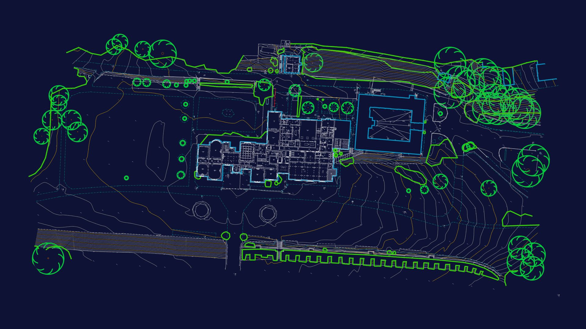
A topographical survey is a detailed measured survey that records the physical features, levels, and boundaries of a site. It is used to create accurate CAD drawings and digital models for design and planning.
Why Topographical Surveys Are Important for Construction Projects
Topographical surveys reduce uncertainty in early design stages by providing accurate site data. They support:
- Planning applications
- Architectural design
- Drainage and infrastructure design
- Earthworks and site modelling
What a Detailed Topographical Survey Includes (UK)
| Survey Element | What It Covers | Why It Matters |
|---|---|---|
| Ground Levels & Contours | Spot heights, elevation changes, contour lines, slope gradients | Helps understand site fall, drainage design, and earthworks planning |
| Buildings & Structures | Existing buildings, extensions, garages, outbuildings, permanent structures | Provides accurate base for architectural design and redevelopment |
| Site Boundaries | Fences, hedges, walls, gates, boundary lines (where accessible) | Defines legal site extents and supports planning submissions |
| Roads, Paths & Hardstanding | Driveways, pavements, roads, kerbs, parking areas, access routes | Essential for access planning and construction logistics |
| Drainage Features | Manholes, gullies, inspection chambers, visible surface drainage | Supports drainage design and flood risk management |
| Visible Utilities & Services | Electrical cabinets, manhole covers, service covers, street lighting | Helps coordinate with underground utility data (e.g. PAS 128) |
| Trees & Vegetation | Individual trees, tree groups, hedgerows, canopy spread | Important for ecology reports and planning constraints |
| Surrounding Context | Adjacent buildings, roads, nearby site features | Helps designers understand external constraints and interfaces |
Frequently Asked Questions
1. What is the purpose of a topographical survey?
A topographical survey provides accurate measurements of a site’s physical features, including ground levels, buildings, boundaries, and infrastructure. It is used to support planning applications, architectural design, and construction planning.
2. When do I need a topographical survey?
You typically need a topographical survey at the early stages of a project, before detailed design begins. It is essential for feasibility studies, planning submissions, and engineering design coordination.
3. How accurate is a topographical survey?
A professional topographical survey is highly accurate, typically achieving millimetre-level precision depending on site conditions and survey methods. This ensures reliable data for CAD and BIM design workflows.