What is a utility survey?
A utility survey is the process of identifying, locating, and mapping underground services to determine their horizontal position, depth, and characteristics. It is undertaken prior to design, excavation, or construction to reduce the risk of striking buried infrastructure.
These services may include:
- Electricity: High & low voltage, street lighting
- Gas: Mains and pipelines
- Water: Potable water pipes and mains
- Drainage: Storm drains, foul sewers, and sewage systems
- Telecommunications: Fibre optic cables, telephone lines, and metallic communication lines.
- Private service connections
- Other: Fuel lines, heating pipes, and unidentified voids or structures
The survey provides spatially accurate data that supports engineering design and safe groundworks.
When is a utility survey required?
Utility surveys are typically commissioned:
- Before excavation or enabling works
- At planning or detailed design stage
- Prior to foundation or drainage design
- For infrastructure upgrades or redevelopment
- To support risk management under CDM regulations
Any project involving ground disturbance benefits from verified subsurface intelligence.
How are underground utilities detected?
A combination of geophysical and surveying techniques ensures reliable detection:
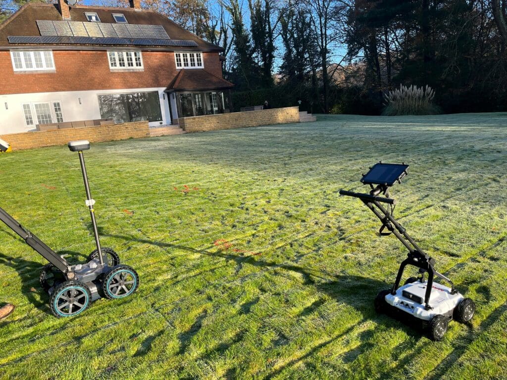
Electromagnetic Location (EML): Detects conductive materials like metallic pipes and cables by applying or tracing an electrical signal.
Ground Penetrating Radar (GPR): Uses high-frequency radar pulses to locate both conductive and non-conductive utilities, including plastic pipes and unknown buried features.
Radio Detection (Rod & Sonde): A sonde transmitter is fed along non-conductive utilities using a rod or cable. Its radio signal is traced at the surface to determine the utility’s position and depth.
Data Correlation: Combines site observations and statutory records with detection results to produce an accurate interpretation of underground services.
Understanding PAS 128
What is PAS 128?
PAS 128 is the British specification that standardises how underground utility surveys are planned, executed, and reported.
It defines required methodologies, accuracy expectations, and, critically, the level of confidence that can be placed in the data.
It ensures surveys are delivered as an engineering-grade dataset rather than a simple detection exercise.
What are the PAS 128 survey types?
PAS 128 defines four survey classifications based on project stage and investigation level:
Type D — Desktop Study
Collection and review of existing utility records only.
Type C — Site Reconnaissance
Records correlated with visible surface features such as covers, chambers, and marker posts.
Type B — Detection Survey
Full geophysical investigation using EML and GPR to locate services.
Type A — Verification Survey
Intrusive investigation (e.g. trial holes or vacuum excavation) to physically expose and measure utilities.
Each type increases certainty and reduces residual risk.
Does PAS 128 define accuracy requirements?
Yes. PAS 128 requires:
- Defined survey tolerances and positioning methodology
- Equipment calibration and validation procedures
- Clear differentiation between detected, inferred, and assumed data
- Traceable metadata and audit documentation
This ensures the dataset is technically defensible and suitable for engineering use.
Understanding PAS 128 Survey Grids (M1–M4)
Type B PAS 128 surveys use a grid pattern to systematically scan a site, with the spacing between lines determining the level of detection confidence. Smaller grid sizes increase accuracy and reduce the risk of missing buried utilities.
- M1 – 5m x 5m: A broad overview, ideal for low-risk, open sites or early feasibility studies.
- M2 – 2m x 2m: A balance between speed and detail, suitable for preliminary design work.
- M3 – 1m x 1m: High-resolution coverage for urban or congested areas where accuracy is critical.
- M4 – 0.5m x 0.5m: Maximum detail and confidence, used for complex, high-density sites or critical excavation zones.
PAS 128 Detection Surveys – Quality Levels (Type B)
PAS 128 assigns Quality Levels (QL-B1 to QL-B4) to indicate the reliability of utility detection. These levels help you understand how confident you can be in the location and depth of underground services:
- QL-B4 – Utility is assumed from records only; not physically detected. Low confidence.
- QL-B3 – Detected using a single method; horizontal position ±500 mm, depth unknown. Medium confidence.
- QL-B2 – Detected using one method with both position and depth; horizontal ±250 mm, depth ±40%. Medium-high confidence.
- QL-B1 – Detected using multiple methods; both position and depth confirmed; horizontal ±150 mm, depth ±15%. High confidence.
Understanding these quality levels ensures your project team can assess risk and plan excavation safely and efficiently.
Post-Processing in PAS 128 Surveys (“P” Designation)
Some Type B surveys include a “P” designation, indicating that the data has been post-processed. This step is used when:
- The site is high-density or complex
- Greater accuracy is required for design or construction
Post-processing refines GPR data, enhancing both position and depth confidence without the need for digging. B-level surveys with a “P” (e.g., B2P, B1P) provide enhanced reliability, helping project teams make safer, more informed decisions during planning and risk management.
Watch our short video below to learn more about Utility Surveys: