A landmark heritage estate of national significance, Gregynog Hall was captured through a fully integrated survey programme, delivering detailed topographical data, high-accuracy BIM modelling, measured building surveys, and drone capture.
Delivering a comprehensive and fully integrated survey, this project focused on the detailed capture of Gregynog Hall and its surrounding estate.
Set within an expansive and historically rich site, the project required a coordinated approach to accurately document both the main house and its associated outbuildings. Careful planning, clear communication, and a flexible delivery model were essential to meet the unique challenges of the site.
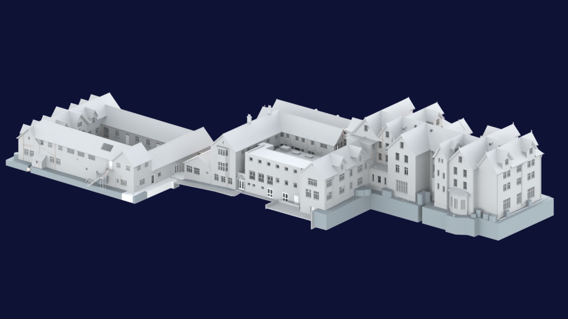
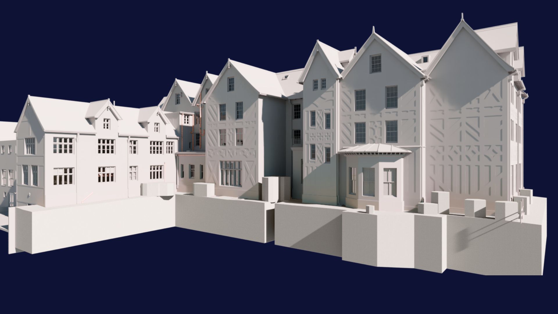
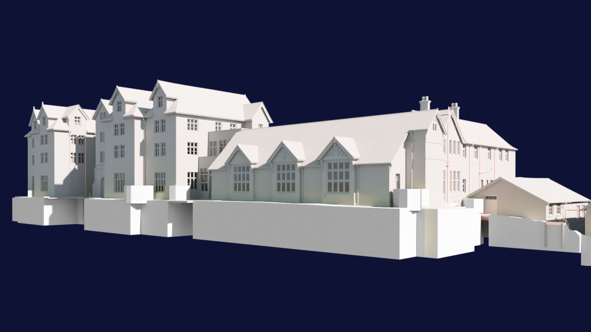
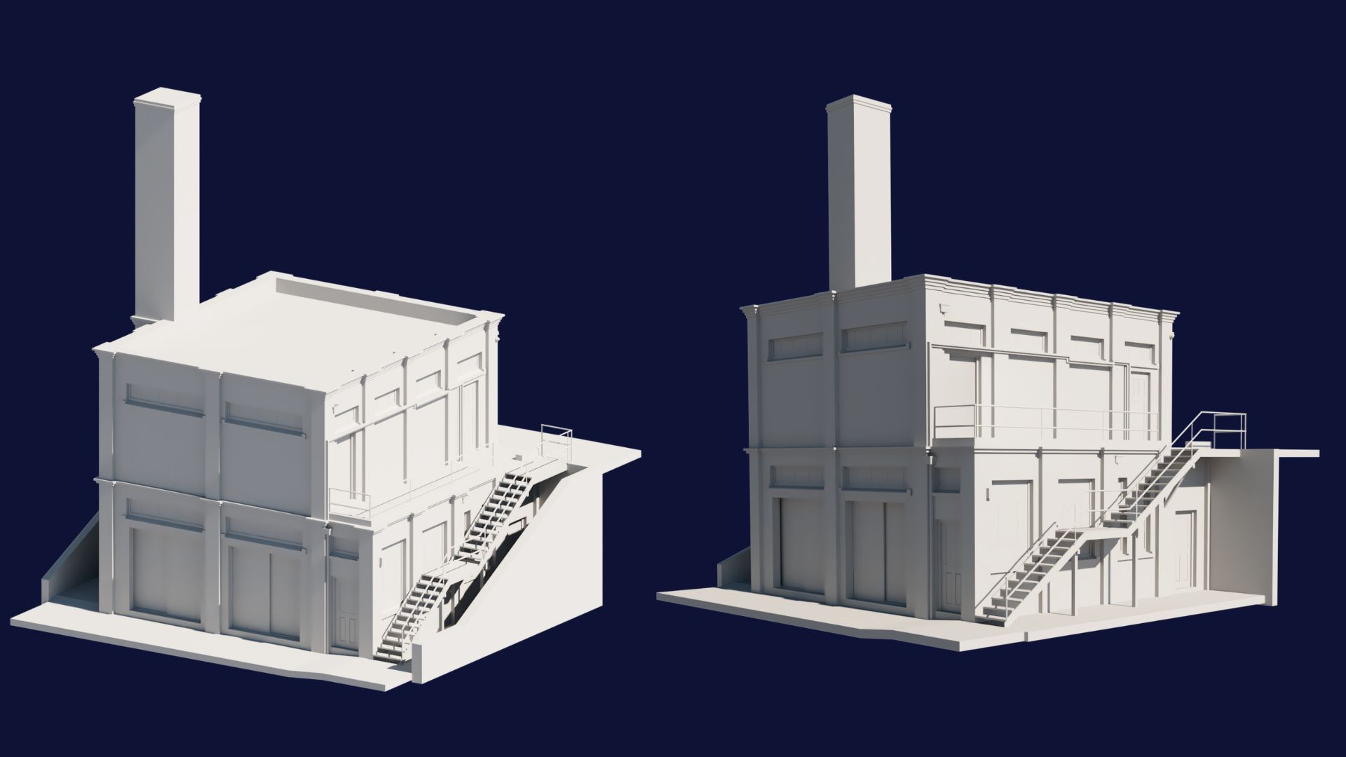
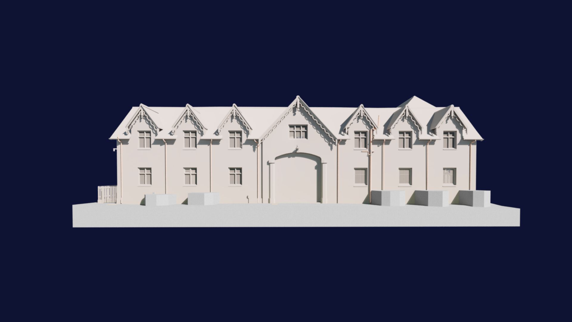
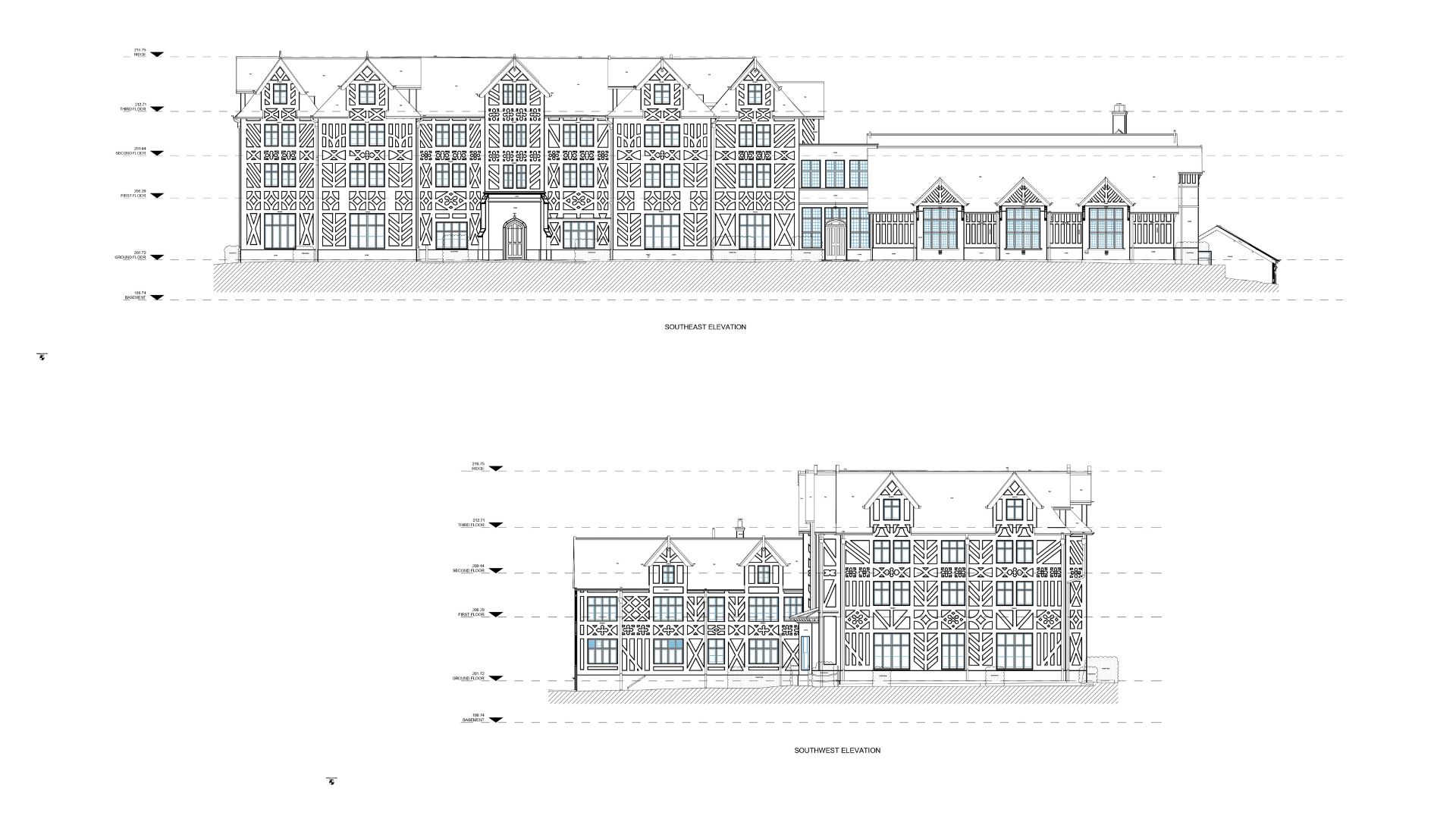
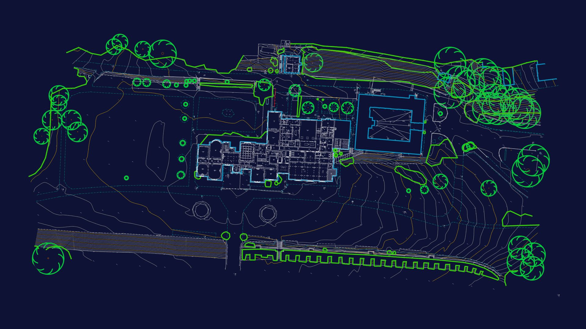
Surveybase were appointed to deliver a fully integrated surveying service at Gregynog Hall, encompassing the main house and its surrounding estate. The scope included a topographical survey of the entire site, detailed 3D BIM modelling of the main hall, modelled to LOD4 externally and LOD3 internally, including intricate external timber features, and the capture of ancillary buildings such as the boiler room and other outbuildings.
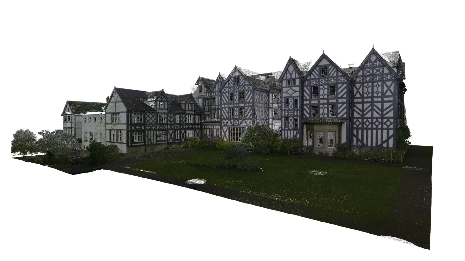
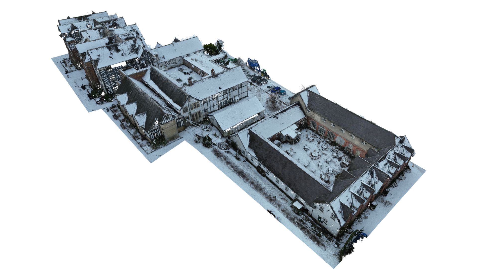
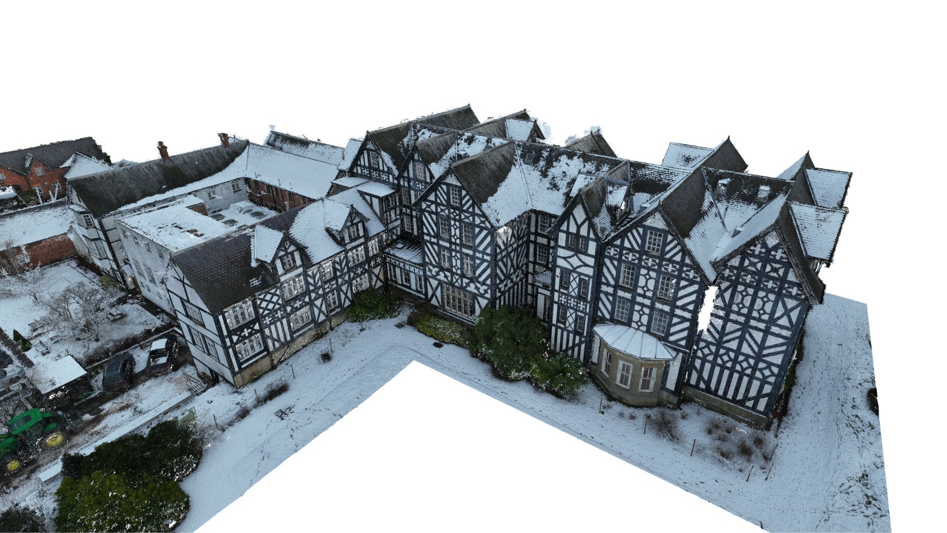
2D Measured building surveys were also undertaken across all key structures, producing accurate floor plans and elevations to support planning and design requirements. A drone survey was carried out to enhance site coverage, and all outputs were underpinned by a full-colour point cloud, providing a precise and visually rich digital record of the estate.
Working within a large and historically significant estate presented its own logistical and coordination challenges. The scale of Gregynog Hall, combined with the variety of buildings and level of detail required, called for a carefully planned and flexible approach to data capture.
This project underscores Surveybase’s commitment to delivering high-quality, cutting-edge surveying services. By providing our surveying services, we ensure clients receive a complete, coordinated and accurate dataset. This approach streamlines the design and planning process, reduces risk, and supports more efficient project delivery.
We combine almost 30 years of business with the latest surveying technology to deliver accurate, efficient, and professional results across the UK. Whether you’re planning a residential development or a large-scale commercial project, our expert team is here to help. To get started, visit our Quote Portal for a fast, tailored quote, or email: quote@surveybase.co.uk.
Since 1997, Surveybase has been a trusted leader in Topographical Surveys, offering nationwide coverage and delivering accurate, high-quality 2D and 3D survey data. Our proven expertise guarantees precise terrain mapping for design, planning, and compliance, ensuring total confidence in your project from the outset.
Since 1997, Surveybase has been a trusted leader in Measured Building Surveys. Providing nationwide coverage, we deliver precise and dependable 2D and 3D outputs, ensuring complete confidence in your project from day one.
Surveybase provides high-precision Drone Surveying & Inspection services across the UK, delivering fast, cost-effective, and detailed aerial data. Our CAA-certified pilots use advanced UAVs with high-resolution cameras and LiDAR for precise, reliable surveys.
Surveybase is a recognised leader in Building Information Modelling (BIM) consultancy, specialising in high-precision 3D BIM Surveys. With our nationwide service, we deliver accurate and reliable modelling data, ensuring complete confidence in your project from the outset.