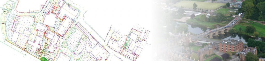
Here we take a look back at one of our largest Topographical Survey’s to date at the historic Monmouth School, South Wales.
The land survey of the complete Monmouth School site in Wales required a team of 4 surveyors to spend 2 weeks on site where the high resolution brief extended beyond the school estate and into the neighboring high street and residential community. The buildings were plotted using our Laser Scanning systems with control provided by GPS. This proved an efficient and accurate procedure reducing the lengthy traverse of the Total Stations.
Monmouth School for boys dates back to as early 1614, although none of the buildings from the 17th century remain as the school was completely rebuilt in the mid to late 19th Century. It is still impressive however that the school have recently celebrated their quartercentenary at St Paul’s Cathedral, London!
For more information on our Topographical Survey’s please visit our Land Survey web page. Alternatively get in touch with the team here on 01225 314370 or email hello@survey-base.co.uk.